
http://www.kaweahriver.org

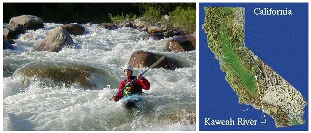
The Kaweah River is located in the foothills of the southern Sierra Nevada
Range of California along Highway 198 at the southern entrance to Sequoia
National Park. The river passes through the small town of Three Rivers and
ends up in Lake Kaweah (Terminus Reservoir). It's one of the shortest
drainages in the US from its headwaters at 12000 feet to Lake Kaweah. The
Kaweah River, like its neighbors the Kings, Tule and Kern, never sees the
Pacific Ocean. Instead, it splits into many channels upon entering the San
Joaquin Valley below Lake Kaweah and is mostly consumed by irrigation. What's
left, if any, ends up in Tulare Lake.
Current Flow Information

Post-A-Gauge Also available as http://postagauge.kaweahriver.org User posted gauge data for the North Fork, South Fork, Dinely Br., Park Boundary, and New for 2009 Hospital Rock
Kaweah 4 day Flow Graph or
Kaweah 1 Month Flow Graph from
dreamflows.com
Rating Table
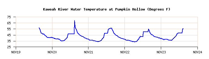
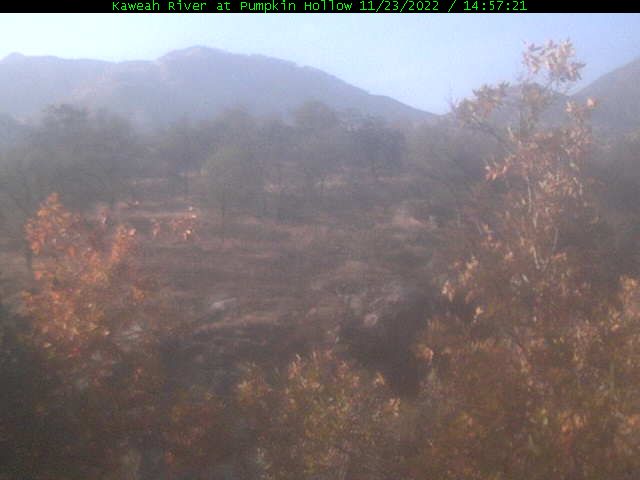
The Kaweah Rivergauge at Pumpkin Hollow Also available as http://rivergauge.kaweahriver.org is not currently reporting.
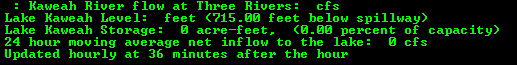
Current Flow at Three Rivers from COE (gauge above Lower Slicky)
10 day Graph or
or
48 hour Table
HOURLY Lake Inflow
Chart or
DAILY Lake Inflow
Chart
Current Weather Information
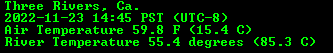
Local weatherstation CW4177 is operated by the Kaweah River Page since 2005. Try all the below links to see what you like best. CWOP site will always be most current as that is where the raw data is uploaded. Other sites get their data from CWOP time delayed.
Local Weatherstation CW4177 on MesoWest
Local Weatherstation CW4177 on National Weather Service (NWS)
Local Weatherstation CW4177 on Weather Underground
Local Weatherstation CW4177 on APRS Finland (pretty darn good graphing of past data)
Local Weatherstation CW4177 on CWOP (APRS network where CW4177 raw WX data is uploaded)
Redirect to Local Pumpkin Hollow Weatherstation CW4177 (KRP local server with the only source of data back to 2005)
Latest Hanford, Ca. Doppler Radar Base Image or
Composite Image from NOAA
Latest Hanford, Ca. Doppler Radar One Hour Base Loop or
One Hour Composite Loop
Local Weather Forecast for Three Rivers, CA from the National Weather Service in Hanford
Hazardous Weather Outlook from the National Weather Service in Hanford
Special Weather Statement from the National Weather Service in Hanford
Winter Weather Advisory from the National Weather Service in Hanford
Severe Thunderstorm Warning from the National Weather Service in Hanford
Other Nearby Weatherstations on MesoWest
Station KAWC1 Lake Kaweah - 540 ft
Station D0117 Three Rivers Museum - 856 ft
Station TSHC1 Ash Mtn. Park Headquarters - 1730 ft.
Station CQ161 Giant Forest - 6234 ft.
Station AT846 Lodgepole - 6690 ft.
Station CSWC1 Case Mountain - 6450 ft.
Station WVTC1 East Fork Kaweah near Redwood Creek - 5240 ft.
Kaweah Flood Cam
Your browser needs to support iframes to see anything. If you see only a black rectangle above then you need an updated modern browser.
Timelapse provided by TimeCam.tv
Direct Link to Kaweah Flood Timelapse Page at TimeCam.tv
The Time Lapse is likely a temporary offering for this flood event only. Enjoy!
Message of the Day
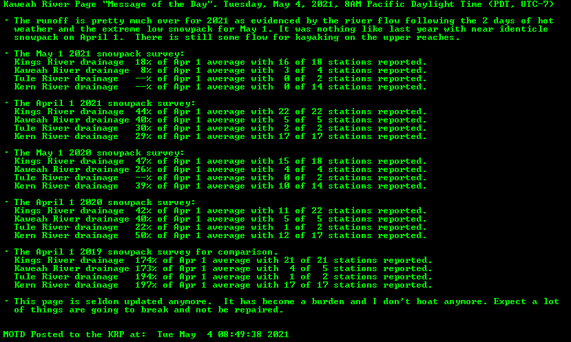 Message of the Day has been added on Oct 25, 2005 to allow the webmaster to post this message remotely from any computer with internet access. The message is displayed as a GIF image
in keeping with the fact that the KRP is a static web page, i.e. it is not generated on the fly. The message image is updated every 15 minutes.
Message of the Day has been added on Oct 25, 2005 to allow the webmaster to post this message remotely from any computer with internet access. The message is displayed as a GIF image
in keeping with the fact that the KRP is a static web page, i.e. it is not generated on the fly. The message image is updated every 15 minutes.
The Kaweah River Page on Twitter
Follow us on Twitter as kaweahriver
Automatic daily twitter updates each morning with the 3AM COE flow at Three Rivers, lake level, and lake level below spillway. Other noteworthy tweets from time to time.
Boater and Kaweah News
Updated Sat, Apr 23, 2016
03-21-2017 The Message of the Day has replaced the Boater News section for the most part becuase it is easier to update. Probably about time to move some the below news into the News Archive.
03-21-2017 The webcam that was watching the river from Feb 7th until Feb 20th has been removed. It may or may not get permanently installed in the future.
04-23-16 The MesoWest weather links that used to go to the ROMAN server now go to MesoWest itself. The ROMAN server is going down on April 27, 2016 due to lack of funding. The data is the same
but formatting was a little better on the ROMAN server.
02-09-15 The California drought continues statewide even worse than last year. The drought can be tracked at the
California Drought Monitor Page .
04-16-14 The 30 runoff forecast graph is posted below in the Spring Runoff section. The do-it-yourself
CNRFC Modeling Page is where you can create a variety of
custom models. The page was used to create the 30 day flow forecast graph on this page.
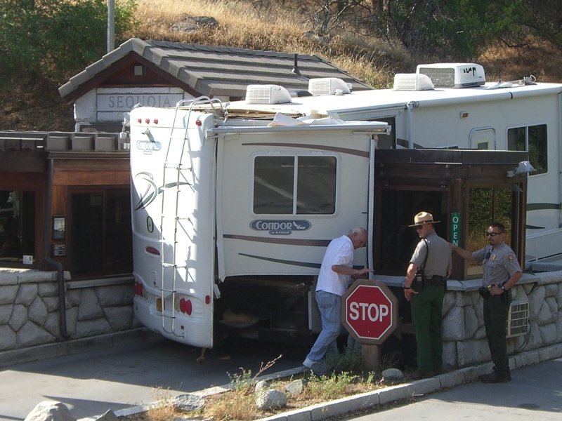
05-15-13 5PM. The KRP breaks the story of the Wedged RV at the park entrance. Looks like it had the expanding bedroom partially deployed when it got
wedged between the two entrance booths. The RV was taken away by towtruck and looked pretty trashed in the rear.
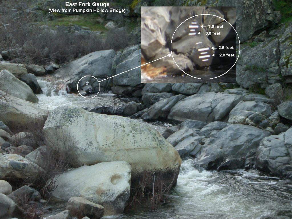
03-15-13 There is a new East Fork River Gauge 90 yards above the Pumpkin Hollow Bridge at the confluence of the Middle Fork easily visible from the bridge. We are
calling the bottom major mark 2.0 feet. Major markings are at half foot intervals and the gauge spans a range of 2 feet. The East Fork should be runable at low flow when the level reaches the lowest minor
mark at 1.75 feet.
07-03-12 Here are the links to the first descent of the Marble Falls Gorge.
Official Blog of the first descent on First Ascent website
National Geographic report
Outside Magazine online report
Lower Marble Fork first descent of a few years back in 2009
06-07-12 FIRST DECENT OF MARBLE FALLS SECTION OF THE MARBLE FORK KAWEAH! Ben Stookesberry and Chris Korbulic completed the first decent of the Marble Falls section of the Marble Fork late Tuesday
evening, June 5th, completing a 8 day expedition just to run the short Marble Falls section. There were a couple days of scouting from Admiration Point and other locations leading up to the boating portion.
Two days were spent setting up for the difficult and dangerous portage of the first two of the five major falls in the gorge. A total of 5 days were spent in the gorge getting the boats down below the first
two falls. With their base camp above the gorge the last day was spent just getting to the boats and the late putin at 5PM saw the completion of the run including the last three major falls, The Twizzler, The
Spout, and Yule Creek in rapid succession. Eric Seymore, Jared Johnson, and Forrest Noble were on the run but bowed out before the gorge but aided in setting up the portage and assisting in getting the two
boats through the portage. Your webmaster caught up with the 4 of 5 guys Wednesday morning getting this first hand report and seeing some of the photos and Go Pro video of the falls section. They called it
possibly one of the most difficult sections of whitewater anywhere. That, I do believe! This section was previously deemed unrunable. This was one of the last pieces of Kaweah drainage to be run. The
expedition was three years in the planning. Time will tell if and when the run will be attempted by others. The KRP will be waiting with baited breath for a "Picure of the Day" commemorating the expedition.
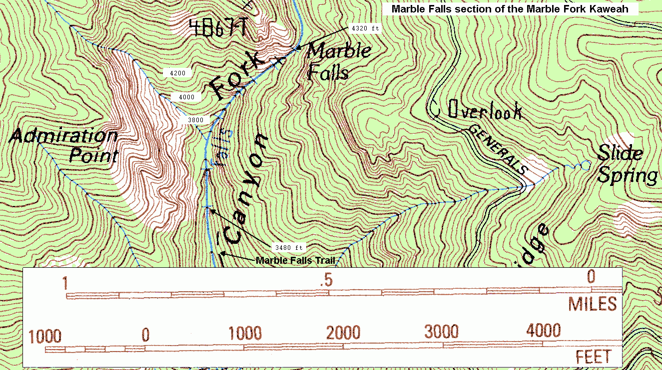
They were boating on about 100 cfs actual flow in the gorge with the COE gauge reporting 400 cfs at Three Rivers. The topo shows the Marble Falls section dropping 840 feet in about four tenths of a mile.
That's over 2000 ft/mile gradient! The start of the gorge is just above river mile 3.0 above the confluence with the Middle Fork.
Click here for a Topo map of the Marble Falls section
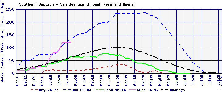
05-05-12 The May 1st snowpack report has the Kaweah drainage at 35% of May 1st average and 27% of April 1st average. The Kern River basin to the south is a dismal 5% of May 1st average and 7%
of April 1st average. The Kings River to the north is 14% of May 1st average and 11% of April 1st average. The Kaweah snowpack is the best of the Southern Sierra.
05-01-12 The peak flow for the 2012 runoff season occurred Friday morning, April 27. The net 24 hour average inflow to the lake peaked Friday morning at 2710 cfs. While not caused by normal
temperature fed runoff conditions, the rain peaked the river to a point that even future hot weather can not surpass. The non rain normal runoff peak occurred on April 23rd.
04-07-12 There was a pretty serious pin on The East Fork Bear Ranch Run Sunday, March 31. It involved one of the young locals being pinned crosswise to the current, boat fully submerged,
nose left, and cockput facing upstream in a fast moving slot of less than a boatlength in width. Rescue was immediate and successful do to safety set up prior to the mishap.After 4 trips in to work
on dislodging the boat and one broken comealong, the boat dislodged itself and was later found downstream. Appearing at first to be totally trashed, thanks to a little warm sun, a hair dryer, a hammer,
and a little time, the boat is back in service nearly as good as new. One tough cookie. "It take's a lickin' and keeps on tickin' ".
04-05-12 The April 1st snowpack report was completed with 4 of the 5 stations surveyed. The Farewell Gap data was not obtained due to the risky conditions getting to the survey location.
The Kaweah basin is at 50% of average. The snowpack graph for the Southern Sierra further down this page shows the season progress and how the snowpack hovers barely above the dry year of 76-77.
Recent April precipitation is helping a bunch.
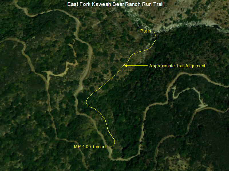
02-10-12 A new
Trail has been built to access the East Fork of the Kaweah slightly above mile River Mile 2.0 above the Middle Fork confluence. The trail opens up the lower
half of the East Fork to those not up too the task of running the more difficult upper section from the Oak Grove or Helipad Put Ins. It also allows for a lower overhead run
that could be done in a couple hours in an afternoon. The trail is all on public land and ends at the river 1/4 mile or so above the point where the old Mineral King wagon road
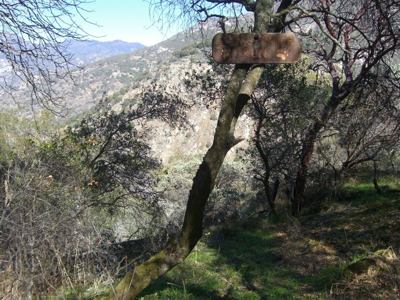
meets the river on private land. The run will be called the Bear Ranch Run. The Bear Ranch Run will be 0.9 miles shorter than the run from the Helipad put in avoids some difficult portages
including the dreaded portage at Dead Mans Alley. While easier than the upper half of the East Fork run it is still a Class V run with a couple of portages depending on your condition.
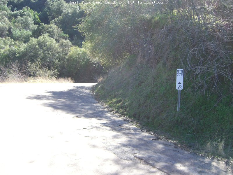
The trail takes off at a large turnout at
MTN 375 Milepost 4.00 on Mineral King Road where plenty of parking is available.
The 0.35 mile trail drops 500 vertical feet to the river and is easy to follow. Plan on about 30 minutes to get to the river. Just follow the most open path. After 100 feet or so you will see the
Bear Ranch Run Trailsign on a tree.
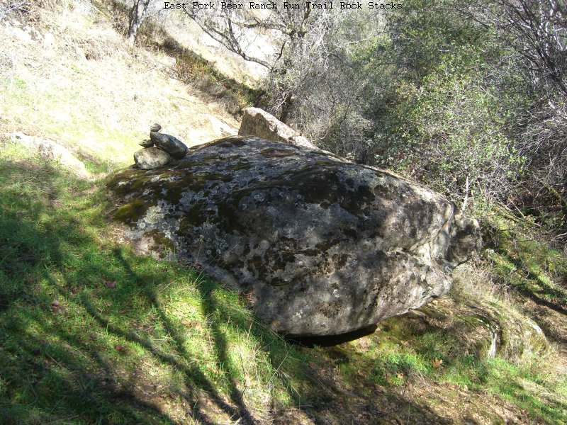
As you decend the trail you will occationally see
Rock Stacks marking the trail location.
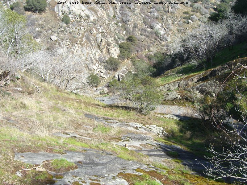
Further down the trail
Crosses the Creek Drainage from it's west bank to the right bank.
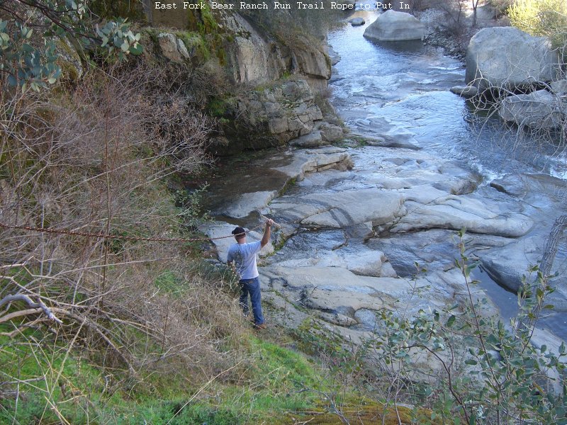
The last 30 vertical feet is steeper and is aided by a permanent
Fixed Rope tied to a tree.
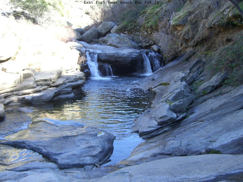
At the bottom of the rope you arrive at the
Put In where nice granite bedrock makes for an easy putin and/or ferry across to hike up and run the falls just upstream.
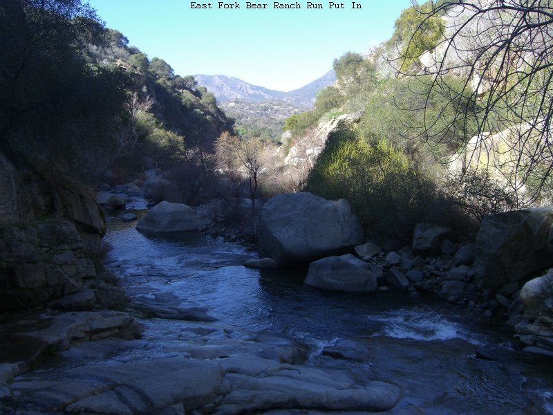
Here is the
View Downstream from the put in. There are no stands of poison oak but there are surely a few isolated stalks of the nasty plant in or adjacent the trail.
A bit more clearing work is needed in the bottom third as of this writing.
Boater News prior to January 2012 has been moved to the News Archive . There is a bunch of good stuff in the archive going all the way back to 2000. The News Archive represents a pretty good
historical timeline of the Kaweah for a decade.
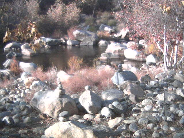
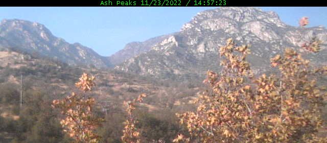
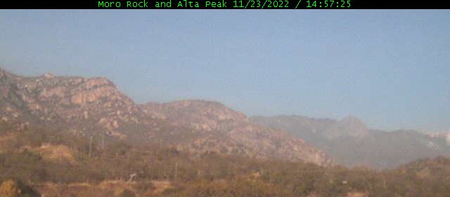
The Kaweah River Webcams: "Kaweah-Cam", Ash Peaks, and Moro Rock
Middle Fork Kaweah at Buckeye Tree Lodge below No. 11 on the Park Boundary section.
The current hours of operation for all webcams are 5:30AM through 8:30PM Pacific Time.
All webcams displayed on one page (now with real time Java clock thanks to timeanddate.com)
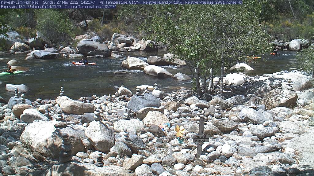
The most recent Raft-Watch sighting as seen by the Hi-Rez kaweah-Cam when programmed to look for rafts
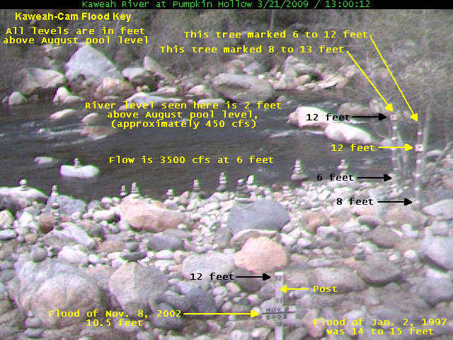
Key to the Kaweah-Cam River Level Markings for flood watch conditions
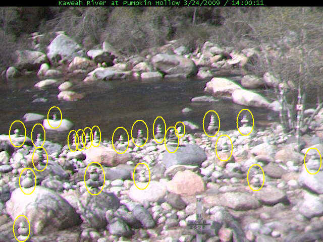
Key to the Kaweah-Cam Rock Formations 22 formations as they were on Mar. 24, 2009 (some will become permanently missing as the water rises)
More about the Kaweah-Cam including the image archive, image correlation to flow, flood images, and more. Also available as http://kaweahcam.kaweahriver.org
The other "Kaweah Kam" is hosted by The Kaweah Commonwealth newspaper in Three Rivers
The Sequoia Park Webcam looks SW into the Kaweah River Drainage from the ridge at Giant Forest
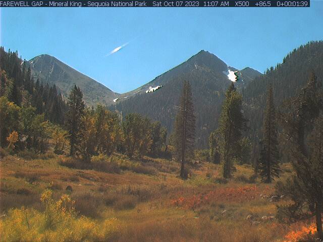
The Newest Mineral King Webcam Image looking toward Farewell Gap
The Latest Mineral King Webcam Image looking toward Timber Gap
The Mineral King Webcam Home Page
The Silver City Webcam
Middle Fork Upstream View and
Downstream View
at Portage No. 11 on the Park Boundary section from the Buckeye Tree Lodge.
The Kaweah Commonwealth Kaweah Kam Timelapse
Your browser needs to support iframes to see anything. If you see only a black rectangle above then you need an updated modern browser.
Timelapse sponsored by TimeCam.tv
Direct Link to TKC Timelapse Page at TimeCam.tv
The Kaweah River Picture of the Day
Kaweah River Picture of the Day Eric Giddens on Dead Mans Alley on The East Fork!
(link launches in new browser window) Turn off your popup blocker if this link fails to work!
Picture of the Day Archive for 2000 through present
The Kaweah River Picture Page
The Kaweah River Picture Page Also available as http://pictures.kaweahriver.org
All the pictures from the 2000 through 2006 seasons. The Picture Page is served by a separate server with always on connection, very fast upload speed
of 5Mb/sec, and infinite file space so all the current and past photos are always available. If you saw me taking your picture somewhere on the river
it is likely to be found here.
The Kaweah Rivergauge Project
Realtime Web Based Rivergauge Project Page This was a 2 year home project that became operational in May 2003.
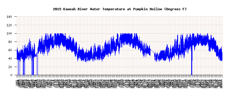
The Kaweah Rivergauge Page Also available as http://rivergauge.kaweahriver.org has the level and water temperature
data and plots reported from the rivergauge. The riverguage will be in real-time operation again in May of 2010.
Other Kaweah River Links worth checking out
Preston Holmes' Upper North Fork Page
Preston Holmes' Hospital Rock Page
Martin Eskes ran the Hospital Rock Section of the Kaweah
as just one stop on his 2001 world Adventure tour
Gary Valle's Yucca Creek pictures (Steep Creek Tributary of the North Fork)
Brett Valle's Best of Sierra Nevada Whitewater
First Descent of CHERRY FALLS on the North Fork Kaweah with NEW Quicktime Videos
1997 saw several First Descents of Kaweah tributaries
Coming attraction: First Descent of Roaring River Falls by Aaron Root in Kings Canyon National Park. (10 years in the waiting...still waiting)
More Weather Information
Temperature, Rainfall and Snowpack Graphs for current conditions in Sequoia National Park. This is one of the
webmaster's favorite links. (plot images in this page are broken ever since DWR reconfigured it's plotting methods and broke a good thing,
the ability to embed DWR plots in a webpage. DWR broke a really good thing and I can't seem to be able to DWR to fix it.)
Weather Forecasts from:
The Weather Channel-Three Rivers,
The Weather Channel-Visalia,
The Weather Channel-Sequoia Park,
USA Today,
Fresno KSEE Channel 24,,
Fresno Intellicast Weather
Spring Runoff Information
Snowpack
Runoff Forecast

Click the images above to go to CNRFC detail pages
Runoff Forecast Report
Peak Runoff Forecast Report
Latest Snow Survey Report
More spring runoff infomation is moved Here.
Flow Graphs and Gauge Data
Flow, Gauge and Flow history is moved Here
Kaweah River Descriptions by Section
The Headwaters of the Kaweah (Expedition Boating) from Cliff Creek to Hospital Rock has been run in the spring of 2004.
The Buckeye Flat Section (Class 5+) from above Buckeye Flat Campground to Hospital Rock adds a mile of difficult water to the Hospital Rock Run.
Hospital Rock Section (Class 5+) Hospital Rock to Marble Fork Confluence
The Marble Fork (Class 5+) from 2.5 miles above the confluence with the Middle Fork was run in 2009 by Ben Stookesberry and Darin McQuoid.
 The Marble Fork (Class 5++) from the Crystal Cave Bridge through the Marble Falls Gorge was run in June 2012 by Ben Stookesberry and Chris Korbulic.
The Upper Marble Fork (Class 5+) from the Generals Highway to Crystal Cave Bridge has been run.
Ash Mountain Section (Class 5+) Marble Fork Confluence to Park Boundary
Extended Park Boundary Run (Class 4+/5) 200 ft/mi The Gorge below Ash Mountain Park Headquarters to the Park Boundary
Park Boundary Run (Class 4+) Park Boundary to East Fork Confluence
Gateway Run (Class 4) East Fork Confluence to Dinely Bridge
Dinely Run (Class 3) Dinely Bridge to Town of Three Rivers
Lake Run (Class 2+)(4) Three Rivers to the Lake
Below the Dam (Class 2+) Dry Creek Road to Woodlake Airport
Dry Creek above the confluence with the Kaweah is unrun and only has enough water during a major rain storm. Probably runnable but with hazards.
The St. Johns River below McKays Point (Class 2+) and across the Valley has been run.
The Kaweah River (Irrigation Canal Boating) below McKays Point is yet unrun.
Lower Lower North Fork (Class 3+T/4) from Bailey Bridge to Middle Fork Confluence
Lower North Fork (Class 3+T/4) from Paradise to Bailey Bridge
North Fork (Class4+/5) from Yucca Creek to Paradise Beach
Yucca Creek (Expedition Boating) has been run from 2 miles above the confluence with the North Fork
Upper North Fork (Class 5) from 5 miles above Yucca Creek
The Headwaters of the North Fork (Cherry Flat section) (Class 5+) starting 9 mile above Yucca Creek was run in July 2010 by Cody Howard et al.
South Fork (Class 3T/5+) from Park Boundary to Middle Fork
East Fork (Class 5+) from Oak Grove Bridge to Middle Fork
Upper East Fork From Lookout Point Trail to Oak Grove Bridge
Upper Upper East Fork (Expedition Boating) From Atwell-Hockett trail crossing to Lookout Point trail has been run
The headwaters of the East Fork from Mineral King Valley to the Atwell-Hockett trail crossing is unrun and is likely unrunnable.
The Marble Fork (Class 5++) from the Crystal Cave Bridge through the Marble Falls Gorge was run in June 2012 by Ben Stookesberry and Chris Korbulic.
The Upper Marble Fork (Class 5+) from the Generals Highway to Crystal Cave Bridge has been run.
Ash Mountain Section (Class 5+) Marble Fork Confluence to Park Boundary
Extended Park Boundary Run (Class 4+/5) 200 ft/mi The Gorge below Ash Mountain Park Headquarters to the Park Boundary
Park Boundary Run (Class 4+) Park Boundary to East Fork Confluence
Gateway Run (Class 4) East Fork Confluence to Dinely Bridge
Dinely Run (Class 3) Dinely Bridge to Town of Three Rivers
Lake Run (Class 2+)(4) Three Rivers to the Lake
Below the Dam (Class 2+) Dry Creek Road to Woodlake Airport
Dry Creek above the confluence with the Kaweah is unrun and only has enough water during a major rain storm. Probably runnable but with hazards.
The St. Johns River below McKays Point (Class 2+) and across the Valley has been run.
The Kaweah River (Irrigation Canal Boating) below McKays Point is yet unrun.
Lower Lower North Fork (Class 3+T/4) from Bailey Bridge to Middle Fork Confluence
Lower North Fork (Class 3+T/4) from Paradise to Bailey Bridge
North Fork (Class4+/5) from Yucca Creek to Paradise Beach
Yucca Creek (Expedition Boating) has been run from 2 miles above the confluence with the North Fork
Upper North Fork (Class 5) from 5 miles above Yucca Creek
The Headwaters of the North Fork (Cherry Flat section) (Class 5+) starting 9 mile above Yucca Creek was run in July 2010 by Cody Howard et al.
South Fork (Class 3T/5+) from Park Boundary to Middle Fork
East Fork (Class 5+) from Oak Grove Bridge to Middle Fork
Upper East Fork From Lookout Point Trail to Oak Grove Bridge
Upper Upper East Fork (Expedition Boating) From Atwell-Hockett trail crossing to Lookout Point trail has been run
The headwaters of the East Fork from Mineral King Valley to the Atwell-Hockett trail crossing is unrun and is likely unrunnable.
Pictures
The Kaweah River Picture Page All the pictures from the 2000 through 2006 seasons
Picture of the Day Archive for the 2000 through 2006 boating seasons.
1998 Kaweah River Boating Vacation Pictures
Preston Holmes runnning Cherry Falls at 2.7 ft
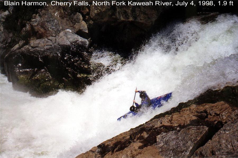
Blain Harmon running Cherry Falls at 1.9 ft
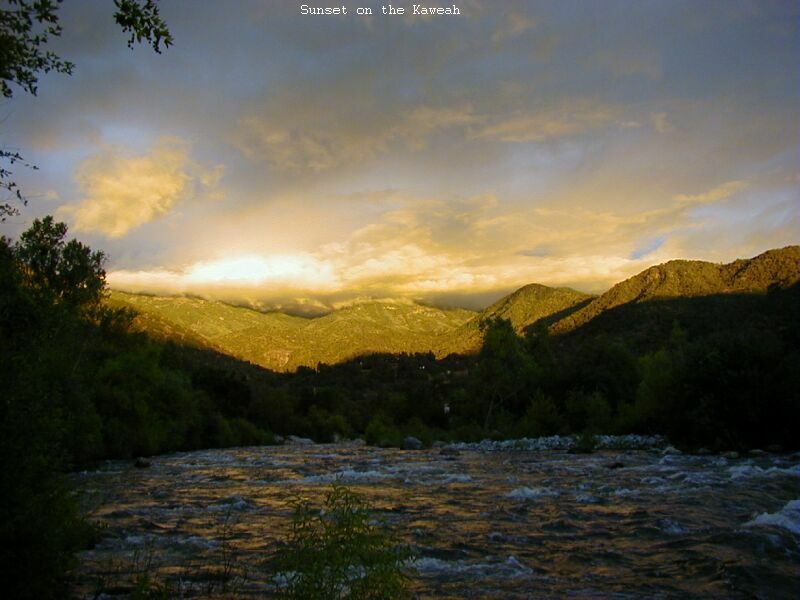
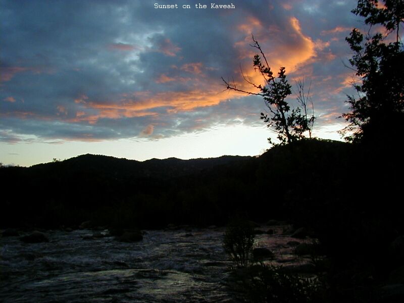
Sunset over Case Mtn. or Sunset to the West
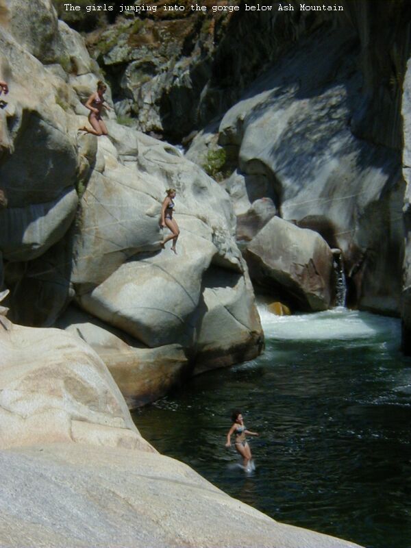
The Girls Cliff Jumping into the Gorge below Ash Mountain.
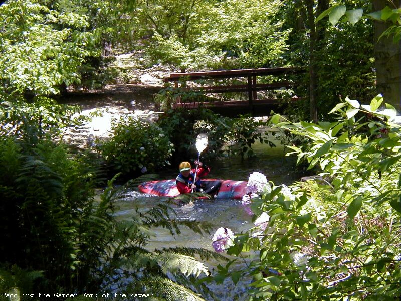
The Gardenfork of the Kaweah ;)
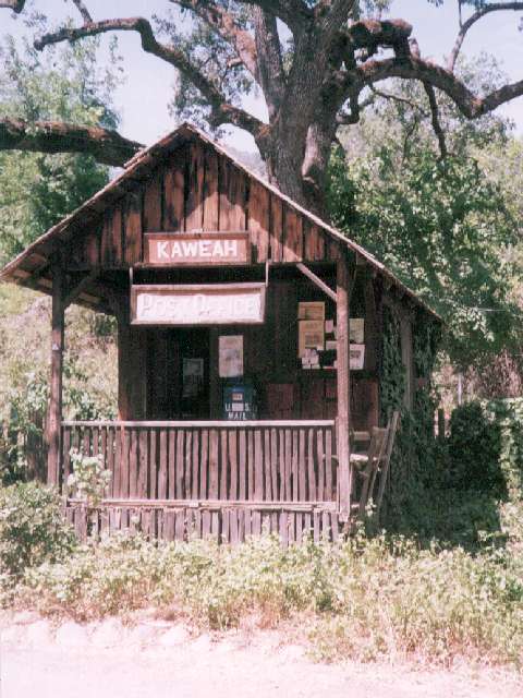
Kaweah Post Office up North Fork Drive
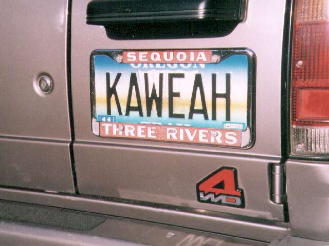
Very Serious "KAWEAH" Boater!
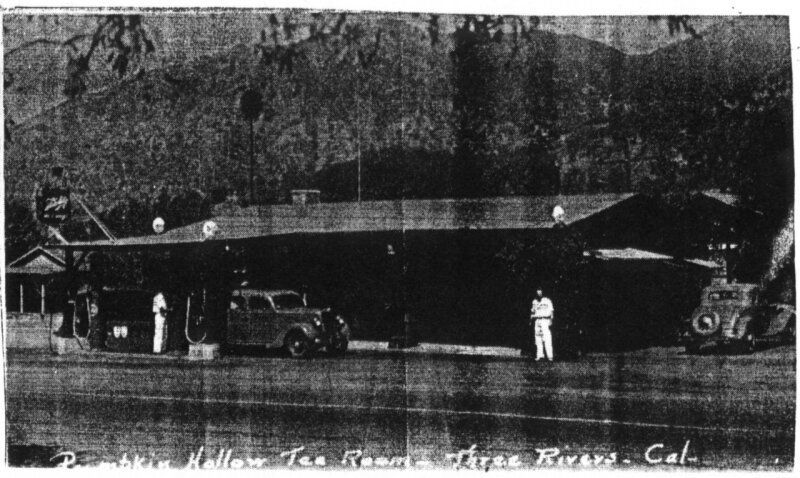
Gas Station at Pumpkin Hollow in the old days
Commercial raft having a normal day at Powerhouse pre 2002 Janet Reno Rock location and
very pre the current Al Gored Rock
Other Related Links
Kaweah Links Page many miscillaneous links for the surrounding area
The Three Rivers Hideaway, Formerly The Three Rivers Motel and RV Park
is under new ownership and management. Located a quarter mile west of Dinely Bridge on Hwy 198 it offers accodations and camping. This
facility is boater friendly and recommended by the KRP as THE boater camping spot! Dave Hammond has done an incredible job of really improving this
facility over what existed with the former owners. Just across the street from the We Three Bakery where you can get the best boater breakfast in Three
Rivers.
The Kaweah Commonwealth Local Three Rivers Newspaper
Sage Root's "Our Trip Video Productions" California Kayaking Video Clips
Get AvantGo get current Kaweah River Flow and other graphs loaded to your Palm
or other PDA every time you sync
Flow Plots for the rest of California
The flood of January 1997
Lake Kaweah Page(US Army Corp of Engineers)
Sequoia and Kings Canyon National Parks
North Fork BLM Recreation Sites
The Mineral KingValley lies 25 miles up the East Fork
The Three Rivers Historical Society
California Department of Water Resources
California Snow Surveys
Calif Data Exchange Center
California Nevada River Forcast Center
US Geolological Survey
Historic Flow Data for all Gauges in Tulare County, Calif.
Friends of the River
Sierra South's Homepage
A reprint of the trailworks.com article about the Kaweah
as it appreared in December of 1999 on the trailworks.com website has been located. You can find it on the Kaweah River Pictures Page.
Army Corp of Engineers Feasibility Report and
EIS Report on the Terminus Dam Raising
The Kaweah had HIGH WATER, in November of 1996
Swimming Holes of the Sequoias(for post runoff recreation)
Sequoia Bed and Breakfast Home Page
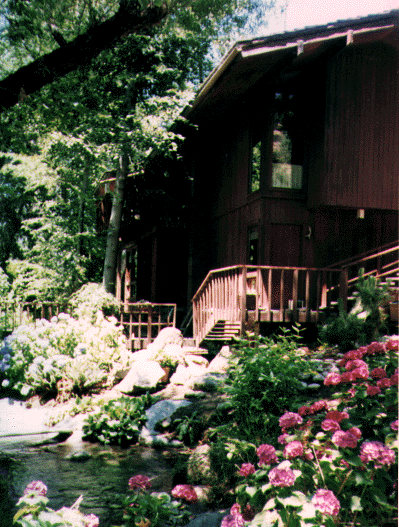
Sequoia Cabins on the East Fork Kaweah
A really cool place to stay just 5.8 miles up the Mineral King Road. Includes East Fork access and swimming hole!
There are more pictures of the Cabins and Trail to the river on the Kaweah Picture Page linked above
Trinity Ranch on the North Fork Kaweah
is under new ownership and is open for business as a place to stay. Nice accodations if you were planning a boating vacation
while the North Fork is running.
Email to the Trinity Ranch for more info
This is what creekin.net says about the Kaweah River
Commercial Rafting Companies on the Kaweah
Copy of the Flyer sent to local residents concerning commercial operation in 2000 (pdf 150KB)

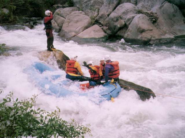
Kaweah White Water Adventures Locally owned, operated, and Recommended by the Kaweah River Page!
KWA offers the highest commercial put in on the river allowing guests to experience 4 more of the best class 4 rapids including Gateway, The Chute, Headwall,
and Osterizer. Also, KWA is the least expensive commercial trip available. Phone 1-800-229-8658 (Toll free) or 559-561-1000 (Local in Three Rivers, Ca.)
Whitewater Voyages
All-Outdoors
Whitewater Connection
Adventure Connection
Wilderness Adventures
American River Recreation
Tributary WhitewaterTours
Beyond Limits Adventures Not licensed on the Kaweah in 2004
ABLE Adventure Tours. Not licensed on the Kaweah in 2004
River Access Problems
The Kaweah is difficut to access because all the land adjoining the river is
privately owned. The traditional put-in at the river left upstream side of
Pumpkin Hollow Bridge at the East Fork confulence was fenced off by the land owner
in the spring of 1994 in cooperation with Cal Trans, the California State Highway Dept.
The only reasonable access point for private boaters is 0.6 miles downstream of Pumpkin
Hollow Bridge at the retaining wall where the highway comes immediately adjacent to the
river. There is some parking downstream along the road. Dinely Bridge, has not been
contested as an access point. The land on the right bank upstream of the bridge is owned
by a public water district. Parking in Three Rivers is available at the School on the south
side of Hwy 198 across from the Chevron Service Station. Click
here for more on the Pumpkin Hollow Bridge Access situation or Click
here for comprehesive general information on the politics of the ongoing Kaweah River Access issue.
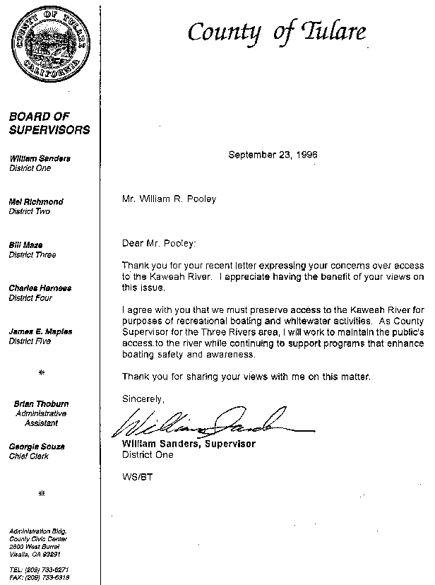
1996 Letter from Mr. William Sanders, then Tulare County Supervisor in regards to future Kaweah River access
Disclaimer: River running is inherently dangerous. Know and understand the
AWA Safety Code
before you attempt any whitewater activities. The author makes no warranties
as to the accuracy of the information contained herein. ....Bla, bla, bla....
Find out more About the Author
or The History of the Kaweah River Page
or Send Email to the author/webmaster at 
or Our Home on the Kaweah River
Internet Provider and Sponser of the Kaweah River Page,
Cunningham and Cunningham Inc. (c2.com) Computer Consultants
Visits since April 1st, 1999  Counter courtesy of digits.net

The Kaweah River Page, http://c2.com/kaweah/Copyright © 1996 through 2016
by Bill Pooley. All rights reserved. The Kaweah River Page is a non profit web site. The links to commercial operations have been freely
donated as well as political endorsements. This web page is Y2K compliant and tediously edited by hand. It contains no browser corrupting,
site slowing Java or Java script, cookies, annoying popup windows and only a rare occational banner ad. The main page is designed to work
with a dialup connection. Only a simple html editor, Araneae, is used to highlight the html syntax during editing. Spelling and errors in
grammar are par for the course, I'm an engineer for Heaven sakes, not an English teacher. This website is best viewed on a monitor with at
least 768x1024 display size and 16 Million colors.
Last modified: 2017-03-21